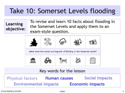
Take 10: Somerset Levels case study

Use this engaging case study resource to summarise and recap key information about the Somerset Levels floods, and practise important exam skills with guidance and support for students.
It uses the principles of dual coding and retrieval process, to help students learn and recall 10 key facts about the Somerset Levels and the flood event, before moving on to apply that knowledge and practise exam technique.
What's included?
The resources include a PowerPoint with a lesson starter and a printable worksheet with revision tips, exam questions and mark schemes for peer and self-assessment.
The case study summary covers the physical and human factors that increased the risk of flooding, including the extreme weather and heavy rain experienced that winter and building on the floodplain. It also includes useful examples of environmental impacts, as well as social impacts and economic impacts of the river flooding. Students will also learn about some of the long-term responses, including the Flood Action Plan created by the Environment Agency and flood defences put in place to mitigate future flooding.
Somerset Levels GCSE case study
The Somerset floods is a useful example for students to use in the weather hazards and climate change topics within the GCSE specifications. This revision resource can be used for all GCSE geography exam boards.
An extract from the 10 facts:
Somerset is in south-west England. The Somerset Levels and moors form an extensive area of low-lying farmland and wetlands.
The area is drained by several rivers, e.g. the river Tone and the Parrett, which flow to the Severn Estuary.
Rivers had not been dredged for at least 20 years and had become clogged with sediment.
Somerset County Council estimated the cost of flood damage to be more than £10 million.
Over 600 houses were flooded - many were evacuated to temporary accommodation for several months.
Local roads were cut off by floods. Bristol to Taunton railway line closed at Bridgwater.
£20 million Flood Action Plan – dredging, raised river banks, raised roads and a pumping station.
